GTS Overview
The Geospatial Tracking System (GTS) helps public health teams understand where, when, by whom and for how long field activities take place. It brings location data together on clear maps, whether collected with an Android phone running GTS Tracker or a dedicated device such as the NtDot.
Introduced as a complementary option within GTS, NtDot helps programmes strengthen field operations and simplify logistics associated with smartphones, including charging and battery management, device durability and theft risk. Programmes can choose the approach that best fits their activities and field context.
GTS is used for vaccination campaigns (door-to-door or at fixed and temporary posts), routine immunization outreach, and other activities where teams visit a list of places. GTS helps teams follow progress, identify locations that may need additional attention, and coordinate supportive follow-up while an activity is underway. Programme teams can also use its maps and indicators to inform planning and reporting.

What GTS does
Records field team tracks. Once tracking is started, GTS Tracker records the phone’s GPS position at regular intervals (every 2 minutes by default), without requiring further action from field staff.
Collects field information. Optional ODK forms completed in GTS Collect (for example, a tally sheet) can be viewed on the map alongside the tracks.
Shows activity coverage. GTS compares tracks with the activity’s Targeted Areas (settlements, grid cells or service locations) and shows which areas were reached, by area, team and day. This can help teams identify where follow-up may be useful.
Identifies sessions at a site. For fixed posts and outreach sessions, GTS identifies places where a team stayed long enough to run a session (stationary activity detection).
Supports outreach microplanning. For routine immunization, GTS proposes localities for each health facility to review and validate (auto microplanning).
Makes results available for coordination and learning. Maps can be shared with a public link where appropriate. Users can download tracks, forms and indicators or connect reporting tools such as Power BI.
GTS components

The phones send their data to the GTS server; the dashboard displays it on maps
Field tracking devices and mobile applications
Field teams can send tracking data to GTS in different ways. They can use an Android phone with the GTS Tracker app, or a dedicated tracking device such as the NtDot. GTS can also receive data from other external tracking devices. The right option depends on the activity and the programme’s needs.
For phone-based tracking, GTS provides three Android applications (see Mobile Apps Overview):
- GTS Tracker
Records tracks during field activities and provides access to relevant forms. It uploads data to the GTS server when the phone has an Internet connection.
- GTS Collect
Displays ODK forms for collecting additional field information. It opens from GTS Tracker and has no separate icon on the phone.
- GTS Store
Helps install the GTS applications and keep them up to date.

The three GTS mobile applications
Web pages
- GTS Dashboard (https://gts.health/)
Your programme’s online workspace for following Tracking Rounds, viewing maps and indicators, and downloading data. Focal points also use its Admin pages to configure GTS.
- Microplan moderation page
A page opened from a link shared by the focal point. Health facility staff use it to review and validate their outreach microplan, without needing a GTS account (see Reviewing your Health Facility Microplan).
- Open Data
A service that reporting tools such as Power BI can use to read GTS data (see Open Data and Reporting (OData)).
How GTS is organized
GTS information is organized in three levels:
Organization: your programme’s GTS space, for example a Ministry of Health or immunization programme. It includes its accounts, field staff, forms and maps.
Field Activity: an activity that field staff select in GTS Tracker, for example MDG Demo - Door-to-door Campaign. It defines how tracks are collected, including the interval, working hours, team codes and forms.
Tracking Round: a period of a Field Activity, for example MDG D2D - July 2026 Round. It defines the dates and Targeted Areas for that period. Maps, indicators and downloads are shown for each Tracking Round.
Who does what
Who |
What they do in GTS |
Start with |
|---|---|---|
GTS support team |
Works alongside your programme to set up its GTS Organization and initial Organization Focal Point account. The team supports account creation and onboarding, coordinates the platform, provides technical support, and offers operational guidance when needed. Contact us: gts@novel-t.ch. |
|
Organization Focal Point and Field Activity Focal Point (for example a national or regional EPI focal point) |
Set up Field Activities and Tracking Rounds, manage Targeted Areas, indicators and accounts, and coordinate team plans and microplans. |
|
Dashboard users (coordinators, supervisors, M&E officers, data analysts) |
Use maps and indicators to understand activity progress, coordinate follow-up, and access data for analysis and reporting. |
|
Field staff (vaccinators, mobilisers, supervisors in the field) |
Use GTS Tracker during working hours and complete relevant forms in GTS Collect. Their field knowledge helps make programme information accurate and useful. |
|
Health facility staff (for example a CSB in Madagascar) |
Review and validate their facility’s outreach microplan, bringing local knowledge to the planning process. No GTS account is needed. |
|
Government and public health partners (Ministries of Health, immunization programmes, regional and district health authorities, NGOs and other implementing partners) |
View a shared Tracking Round map through a public link, supporting coordination and review without needing a GTS account. |
What a dashboard user can see and change depends on their role (Member, Organization Focal Point, Field Activity Focal Point, Data Analyst, Logistics Support). The Organization Focal Point assigns roles so each person has the access needed for their work. Dashboard users can open maps of the Tracking Rounds available to their Organization and download their data; only focal points see the Admin pages. See Dashboard User Roles in the Administrator guide.
Open the map of a Tracking Round
Go to https://gts.health/ and click Connect to GTS.
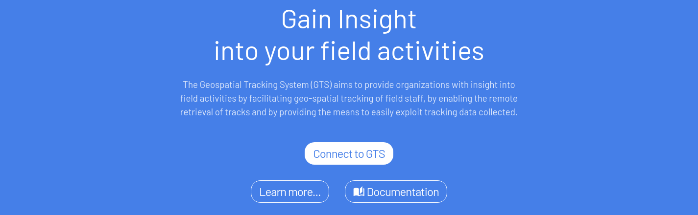
GTS home page: click Connect to GTS
Sign in with the user name and password of your dashboard account.
The Tracking Round Selection page opens. It lists the Tracking Rounds you can see, with their main indicators.
Click Map > on the row of a round to open its map.
To come back to this page from the map, open the menu (three lines, next to your user name) and click TR Selection. The same menu gives access to Admin (focal points only), Help and Log out.
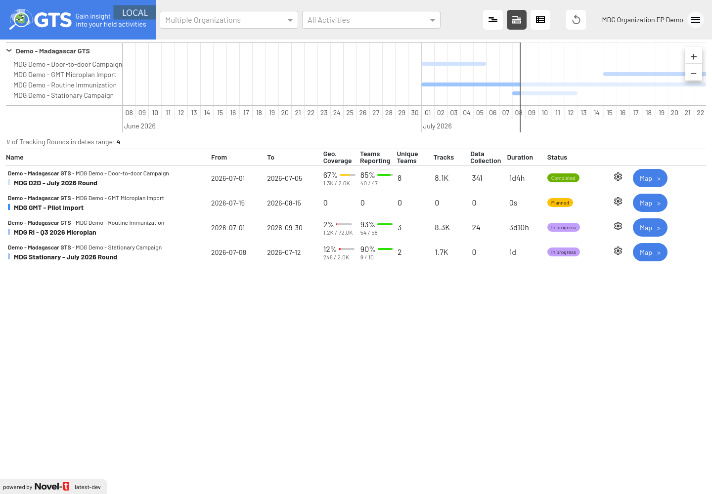
The Tracking Round Selection page, with the Map > button of each round
Note
GTS cannot sign you in if the date, time or time zone of your computer or phone is wrong. It then shows a red message: Clock synchronization error: Your device date, time, or timezone appears to be out of sync, preventing authentication…, followed by the same text in French. Set the date, time and time zone of your device to automatic, then click reload the page in the message.
Where to start
I want to… |
Read |
|---|---|
Understand how GTS supports a door-to-door campaign |
|
Monitor fixed posts or a campaign held at sites |
|
Monitor routine immunization outreach sessions |
|
Find a Tracking Round and open its map |
|
Read the map and find the areas not visited |
|
Understand the indicators and team reporting |
|
Go to a place shown on the map (an area not visited, a team) |
|
Share a map with people who have no GTS account |
|
Download tracks, forms or indicators |
Downloads and GPS tracks, ODK form submissions, Geocoverage indicators and Targeted Areas |
Connect Power BI or another reporting tool |
|
Prepare the outreach microplans of health facilities |
Auto Microplanning (Administrators), Validated Microplans and Exports |
Review the microplan of my health facility |
|
Install and use GTS on the phones |
|
Prepare, run and close a campaign (checklists) |
Door-to-door campaign checklists, Get the missed settlement list |
Prepare the Targeted Areas, base layers and forms |
|
Configure GTS (focal points) |