Guide Me to a Location
Guide me to this location turns the map into a guidance screen that leads you, on foot or by vehicle, to a place shown on the map: a targeted area that has not been visited, the last track point of a team, a data collection point, a stationary activity site, or any other place. Supervisors use it to check the work of the teams on the ground or to reach a team, without leaving GTS.
It works best on a phone, which has a GPS and a compass. It also works on a tablet or a computer, and on maps opened with a public link.
Note
Your position stays on your phone: GTS does not send it to the server and does not save it. The arrow and the distance are measured in a straight line; they do not follow roads or paths. For directions by road, use Open in Google Maps (see More options).
Start the guidance
From an object of the map
Tap (or click) a targeted area, a track point, a data collection point or a stationary activity site. Its details open (see Map Overview). When several objects are under your finger, use the arrows at the bottom of the window to show the one you want.
Tap Guide me to this location at the bottom of the window.
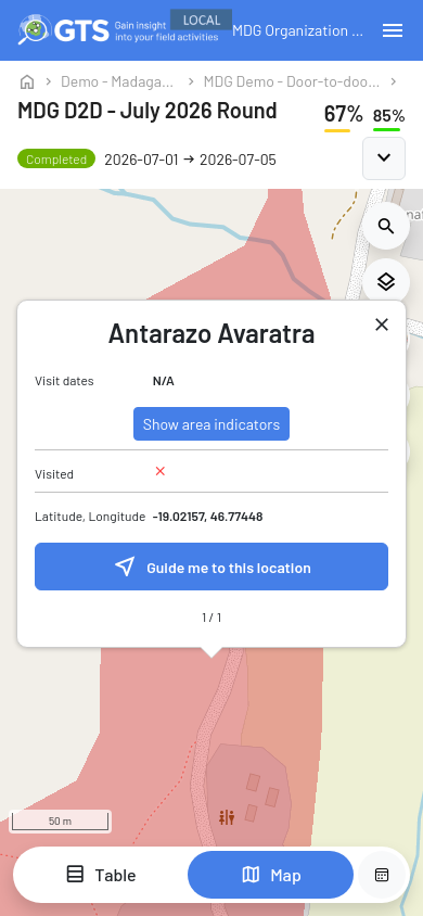
Details of a targeted area on a phone, with Guide me to this location
From any place
On a phone or a tablet, keep your finger on the place for about half a second (long press). On a computer, right-click the place.
A small window shows Selected location and its latitude and longitude. Tap Guide me to this location.
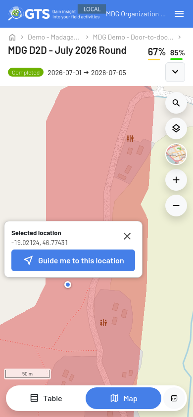
Selected location window opened with a long press
Allow access to your location
The first time, GTS explains why it needs your location (Allow location access?). Tap Allow location, then accept the request of your browser. Not now cancels the guidance. On an iPhone, Safari also asks for access to the motion and orientation of the phone: accept it to use the compass.
If access to your location was refused, GTS shows Location access is blocked. To allow it again:
Chrome (Android): tap the icon on the left of the address bar, then Permissions > Location, and allow it.
Safari (iPhone): tap aA in the address bar, then Website Settings > Location > Allow.
Also check that the location (GPS) of the phone is switched on.
The window also offers Open in Google Maps, which opens the place in Google Maps instead.
If the browser cannot give your location on this page at all, GTS shows Location unavailable instead, with the same Open in Google Maps button.
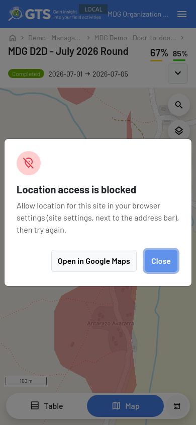
Location access is blocked, with Open in Google Maps as an alternative
Follow the guidance
The map takes the whole screen. The bar at the top shows Exit guidance, the target (Guidance to …) and the three-dot menu (More options).
On the map:
the blue dot is your position; the light blue circle around it shows the accuracy of the GPS, and the cone shows the direction the phone is facing;
the red pin marks the target; a targeted area is also outlined in red;
the dashed line joins you to the closest point of the target in a straight line.
The card at the bottom of the screen shows:
an arrow pointing to the target;
the direction to follow, for example Head northwest, and the distance in a straight line, for example 298 m;
the quality of your position, for example GPS ±12 m · 2 s ago.
The arrow
On a phone with a compass, the arrow turns with the phone: hold the phone flat in front of you and walk where the arrow points.
Without a compass (computer, compass turned off or not available), the arrow shows the direction on the map, where north is at the top: the small N↑ next to the arrow reminds you of it. While you are moving, GTS uses the direction of your movement instead.
The map follows you as you move. If you move or zoom the map yourself, it stops following you: tap the Center on my location button (target icon, above the card) to follow your position again. The screen of the phone stays on during the guidance, on the browsers that support it.
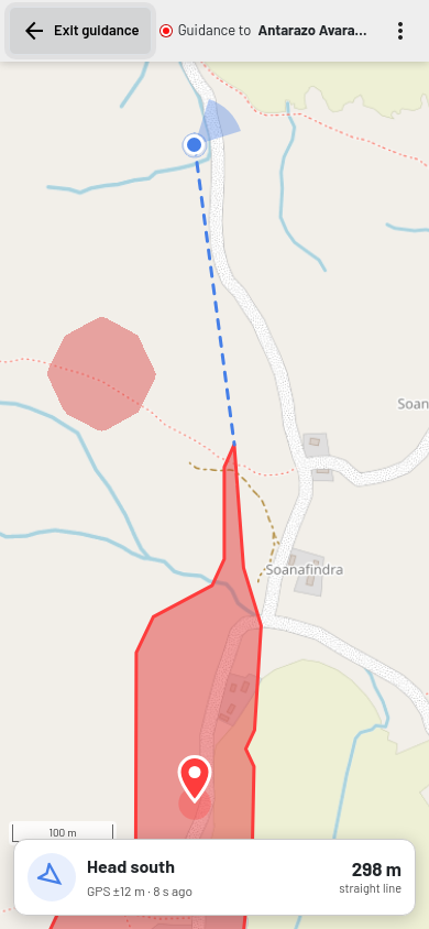
Guidance to a targeted area 298 m to the south: the phone faces north-east (blue cone), so the arrow points back to the right, towards the target
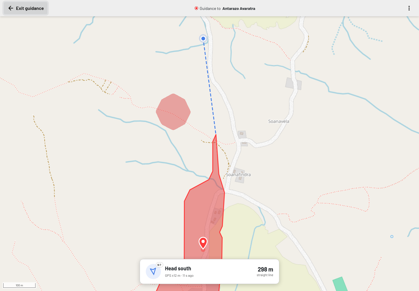
Guidance on a computer: the arrow is relative to north (N↑)
Arrive at the target
Targeted area: until you reach it, the arrow and the distance lead to the closest edge of the area. As soon as you are inside, the card shows You are inside followed by the name of the area.
Point (track point, data collection point, site, selected location): the card shows You have arrived when you are within 20 m of it, or within the accuracy of the GPS when it is less precise.
On Android phones, the phone also vibrates once when you arrive.
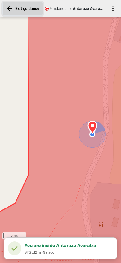
You are inside the targeted area
Messages on the card
Message |
Meaning |
|---|---|
Looking for your location… |
GTS is waiting for the first position from the phone. Outdoors it usually takes a few seconds. |
Location unavailable (Check that location (GPS) is on) |
The phone gives no position: its location is switched off, or there is no GPS signal (inside a building). GTS keeps trying. |
Low accuracy |
The position is less precise than 100 m, which is common on a computer (located through Wi-Fi) or indoors. The direction and the distance may be wrong. |
No recent GPS fix |
The last position is more than 30 seconds old. Move to an open place. |
More options
The three-dot menu of the top bar offers:
Open in Google Maps: directions by road to the target in Google Maps (the app on a phone, the website on a computer). Use it when the straight line is not practical, for example to drive to a distant area.
Compass: on / Compass: off: only on phones with a compass. Turn the compass off if the arrow is unstable, for example near metal or inside a vehicle; the arrow then shows the direction on the map. If the compass seems wrong, move the phone in a figure-eight a few times to calibrate it.
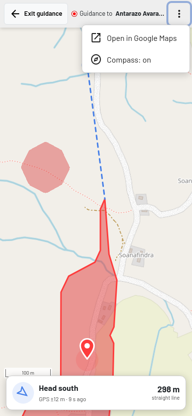
The three-dot menu: Open in Google Maps and Compass
Exit the guidance
Tap Exit guidance, or the Back button of the phone or of the browser. The map comes back with the same period and panels. It stays where the guidance ended (around your position and the target), and the details window is closed.
Without internet
Once the guidance has started, it keeps working without internet: the position, the arrow, the distance and the messages are computed on the phone. Only the background map needs a connection for the parts not displayed yet. Before going to an area with no network, start the guidance and look at the map around the target and along the way: the parts already displayed usually remain visible as long as the page stays open.