Release 1.5
Deployed on September 22, 2021
The GTS version 1.5 release includes the following new features and enhancements:
New Features
Map Display:
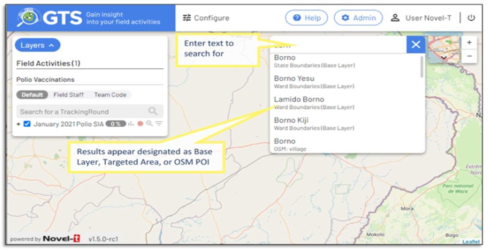
Navigate to control: Click on the new control and enter at least three characters to select and zoom to either a Base Layer item, targeted area or Open Street Map point of interest.
Administration:
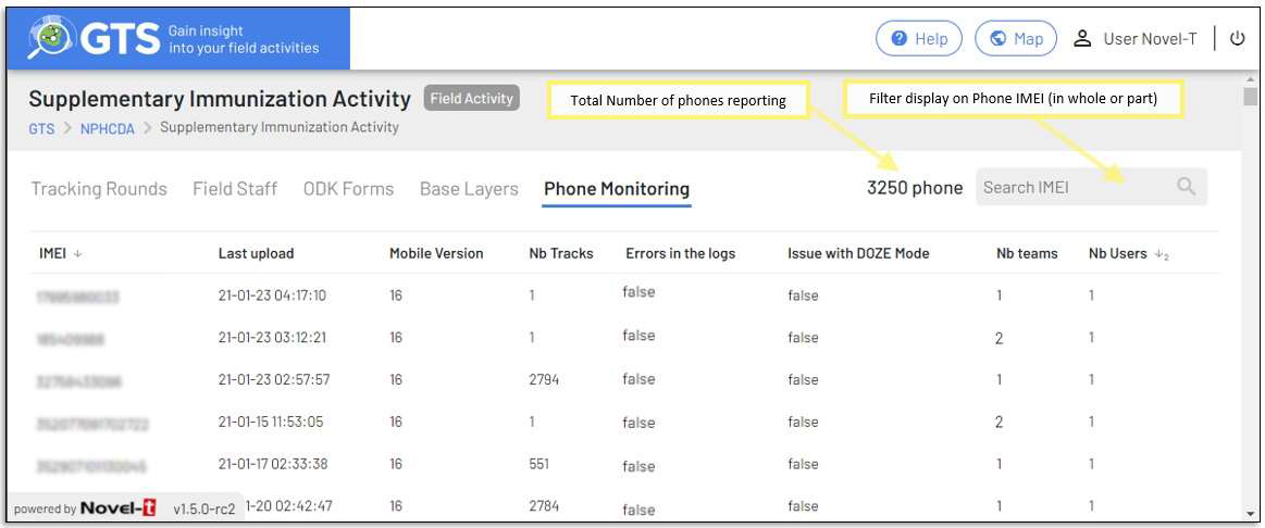
Phone Monitoring: A new phone monitoring tab assists in the administration and analysis of Android devices uploading tracks for the field activity.
Dashboard:
Online Help: An online user guide has been introduced that is accessible throughout the dashboard by clicking on button on the main page or buttons on the popup forms.
Enhancements:
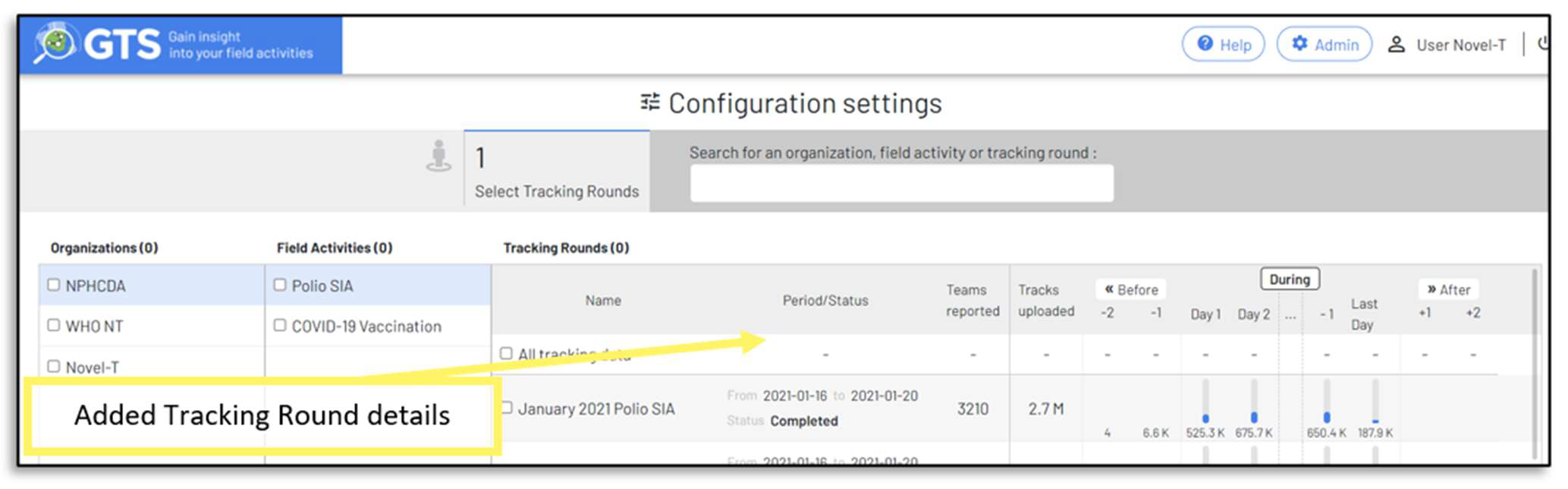
Map Configuration Settings:
When selecting Tracking Rounds for map display, greater detail concerning rounds are now available in the Configuration Settings (start/end dates, status, number of teams, total tracks uploaded, tracks uploaded per day).
Map Display:
Advanced filtering of tracks: Clicking on the Filter icon now includes options to filter on:
Speed: The speed range at which the tracking device was moving, as determined by the GPS signal, of the tracks to display.
Hours: The track collection time range of the tracks to display.
IMEI: Unique ID (International Mobile Equipment Identity), to display tracks from particular phone(s)

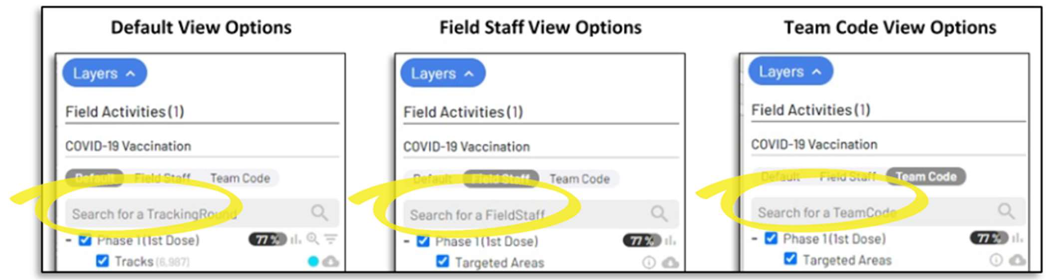
Search and filtering of displayed/downloaded tracks by names of Tracking Round, Field Staff or Team Code has been added to the Map Inset.
Geo-Coverage:
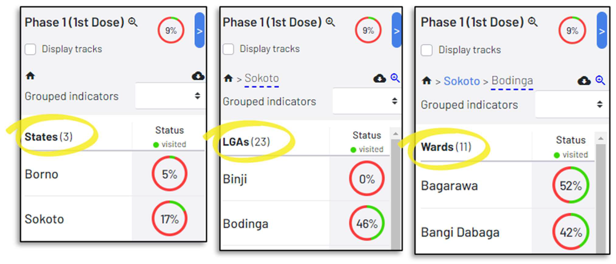
Grouped totals: The targeted areas progress is now indicated by selected grouped indicators in the map inset:

Aggregation layer names are now used as titles of base layers rather than the text “Base Layers”
Excel Exports have been enhanced to include summed and average indicators if they exist in the targeted areas layer.
Administration:
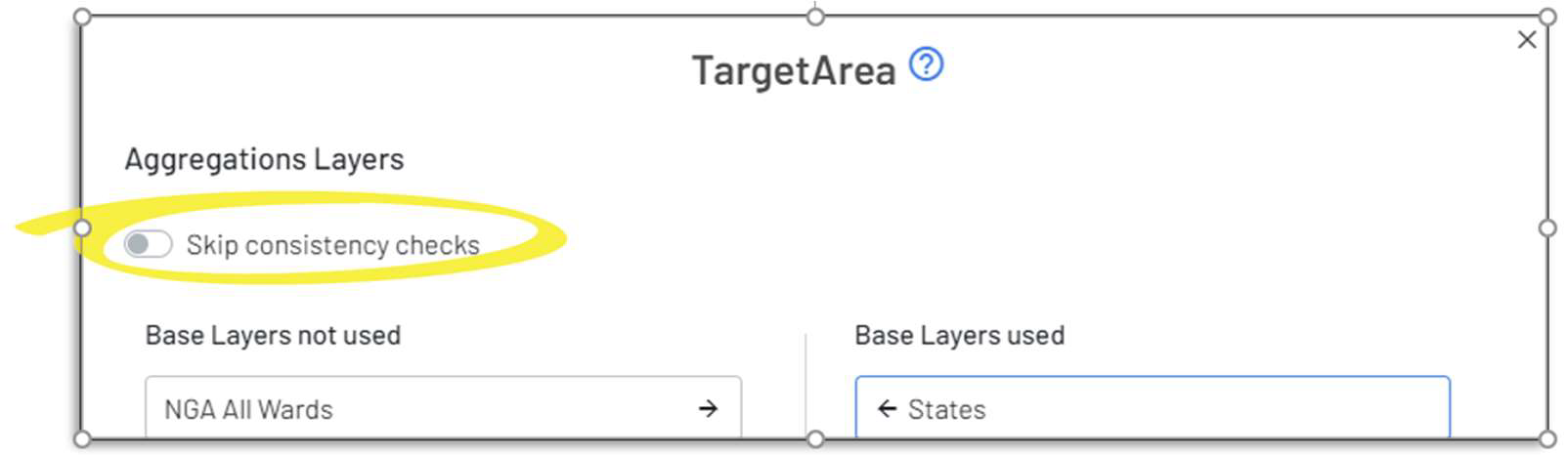
Base Layer assignment to Targeted Areas now incorporates consistency checks to ensure correct sequence when assigned.
Mobile:
If battery optimization issues encountered on the mobile device a warning is sent to the dashboard and displayed in the Phone Monitoring section
GTS Tracker assets (Field Activity configuration, ODK Forms) are systematically refreshed to the GTS tracker before tracking starts if connectivity exists.
GTS Components
Updates of various underlying software components (Angular, Celery, GeoServer, Keycloak, Python version of API & Celery)