The Field Activity level permits editing of details and configuration for field activities. Organization Focal Points and Field Activity
Focal Points can edit field activity details.
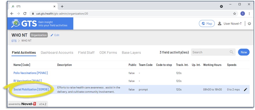
To access the Field Activity level of the administration console in the GTS Dashboard; click on the field activity name from within the
Field Activity tab at the Organization level:
Tracking rounds are filtered sets of tracks collected by identified field staff over a defined time period for a specific field activity. They may have working hours and
validation speeds assigned for dashboard map display and analysis purposes.
Note
Every field activity is automatically assigned a default tracking round named “All tracking data”, this tracking round has no date limits, defaults to the working hours and
speed limits of the Field Activity and includes all field staff assigned to the field activity.
To create a new Tracking Round, navigate to the tracking rounds tab at the field activity level and click on the “New” button.
A public link feature allow you to give access to people without GTS account to a specific tracking round.
Note: Only people that have the link will be able to access it and the link contain encrypted information to avoid guessing.
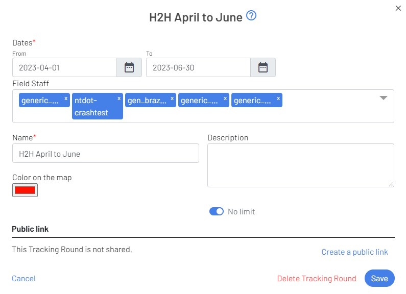
To create it, start by clicking the Create a public link link. New fields as the screenshot below will be visible.
GTS Dashboard new tracking round form with public link option
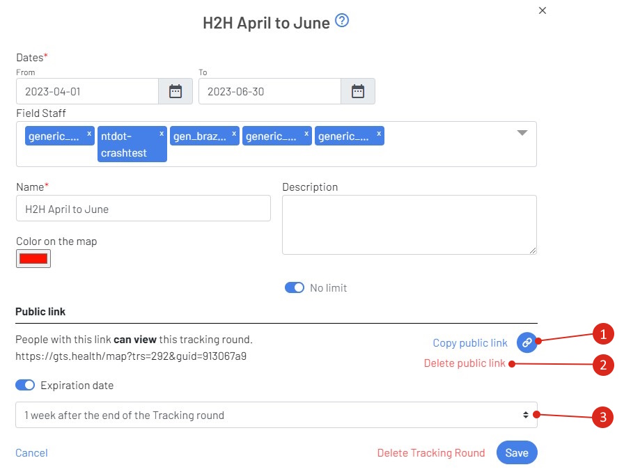
To share the link, you can select it on the left side, or click the Copy public link link (point 1 in the screenshot)
If you don’t want to share this tracking round anymore, click the Delete public link link (point 2 in the screenshot)
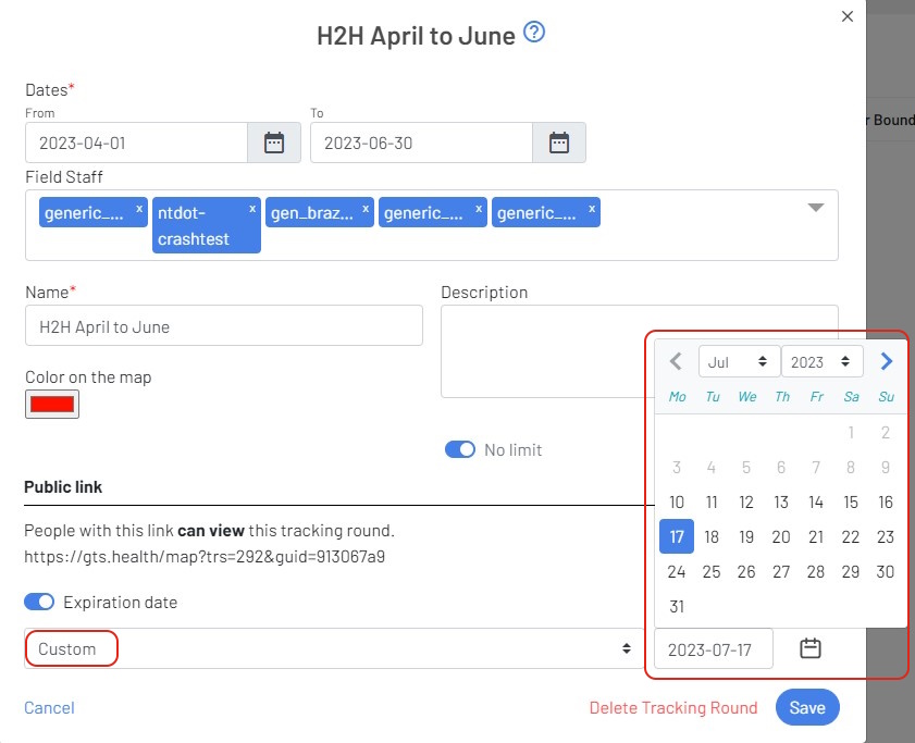
By default, a public link will be available until 1 week after the end of the tracking round. (point 3 in the screenshot**). You can use the expiration drop-down to select another predefined duration, of select the Custom to get access to a date pick and put a custom expiry date
To avoid expiry date, click on the Expiration date button.
GTS Dashboard new tracking round form with public link option and custom expiry date.
At the end of your settings, click the Save button to save your changes.
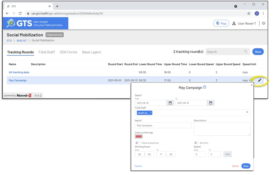
To edit a tracking round, click on the pencil icon to the right of the tracking round entry (this form is not available for the “All tracking Data” round:
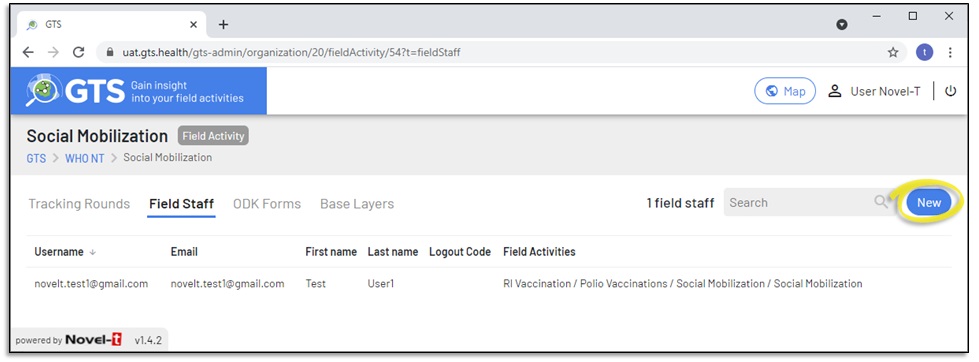
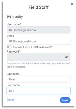
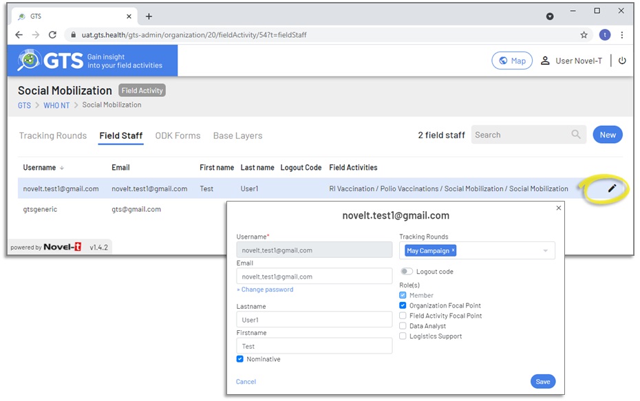
The Field Staff tab lists all users that may be assigned mobile application access for the Field Activity, field staff may be nominative
or generic. To create a new field staff account at the field activity level, navigate to the Field Staff tab at the field activity level and click on the “New” button.
GTS Dashboard Admin Field Staff tab at the field activity level
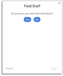
To create field staff new to the GTS, follow these steps after pressing the “New” button on the Field Staff tab:
To edit existing field staff after they have been created click on the edit (pencil) icon that appears to the
right when hovering over the account entry.
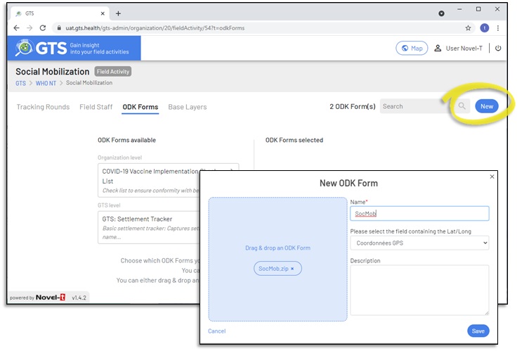
ODK forms may be associated with field activities, field staff will be able to use forms to capture contextual information from the Android device while
performing a field activity. ODK forms uploaded to the Field Activity level will only be available for that field activity.
From the ODK tab, it is possible to view ODK forms that will be available for the field activity, either at the GTS, Organizational or Field Activity level.
Click on the “New” button in the ODK tab at the field activity level, to add an ODK form that will be available to all tracking rounds in the field activity.
Drag and drop or browse to upload the .xml or .zip file that contains the ODK form. A name must be assigned to the form, the GTS automatically updates
the popup form with the name of a field that collects geo-coordinates, this may be changed if there are more than one geo-location widget on the form.
ODK forms may be uploaded either as XLSForm .xml files or as .zip archives that contain the .xml files and any associated itemsets.csv files and
media directories for media files.
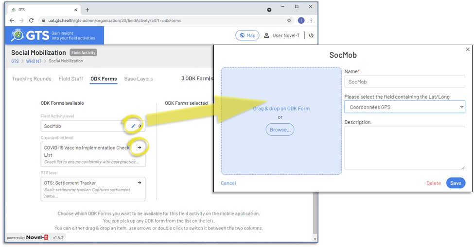
Once uploaded, ODK forms appear in the “ODK Forms Available” column, only forms uploaded at the Field Activity level may be edited from this tab. To edit an ODK form click
on the pencil icon, Any forms that appear in the available column may be select of use during the field activity by clicking on the arrow and moving the form to the “ODK
Forms Selected” column. A field activity
may have more than one ODK from made avaiable.
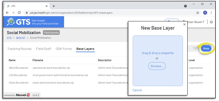
Base layers are nested shapefiles used for aggregation and geographic investigation. Typically base layers represent administrative boundary levels
(level 0 country, level 1 first sub-division etc.); however base layers may include any shapefiles that respond to field activity analysis needs such as
health zones divisions, water sheds, and the like.
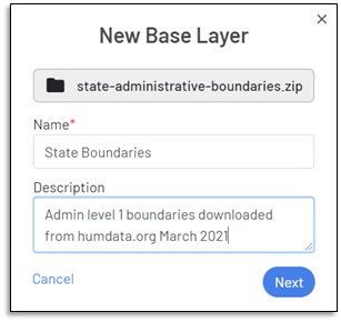
Click on “New” to upload a base layer. Base layers must be in ESRI Shapefile format within a .zip archive file.
Uploading Base Layers at the Field Activity level
The Base Layer upload wizard will present the following forms for completion.
I) Enter a name and optionl description for the Base Layer
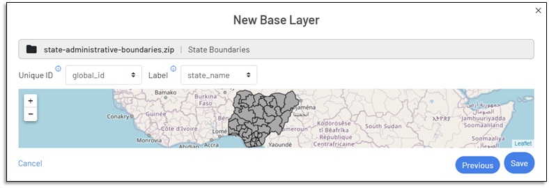
II) Select fields as Unique ID (for eventual time trend analysis) and Label (for map display and search funtionality) then click on the “Save” button to
uploaded base layer.
III) Upon successful upload, the GTS will return a “Success” message and the base layer will appear in the list.
Once uploaded, Base layers may be edited or deleted as a function of their level and the role of the user editing the form. Base layers will
be used in conjuncture with Targeted Areas layers to provide aggregated geographic analysis. For example the number and percentage of targeted
areas visited at the state, local and ward levels.
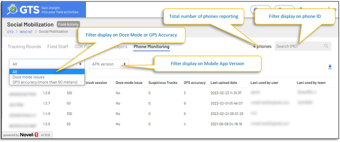
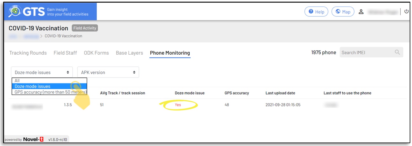
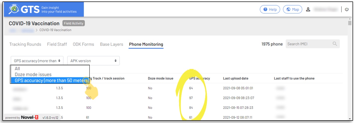
The Field Activity Device Monitoring tab (previously Phone Monitoring) assists in the administration and analysis of Android devices uploading tracks for the
field activity. It describes the state of the GTS mobile application when the device last uploaded tracks providing details as described in the table below:
The unique identifier of the android device (International Mobile Equipment Identity) or NT· S/N (Serial number).
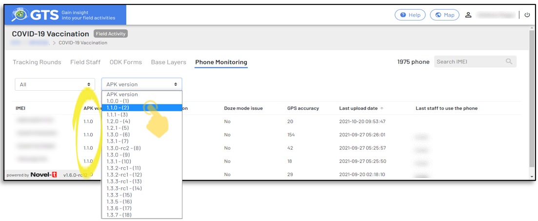
Device Version (previously APK Version)
Version of the GTS Mobile Tracker installed on the device.
Avg Track / track session
The average number of tracks included in a upload.
Doze mode issues
A check if the device is properly configured for batery optimization.
Suspicious Tracks
A check if tracks uploaded display anomalies that should be investigated.
GPS accuracy
The reported acuuracy of the last GPS signal in meters.
Last Upload date
Date at which the server last received tracks from the device.
Last used by user
The login that last uploaded tracks from the device.
Last used by team
The Team code that last uploaded tracks from the device.
Doze mode is an Android operating system feature that is designed to prolong battery life by putting applications into a suspended state when they are not actively used.
The GTS mobile application must not be optimized for battery life savings as this setting may result in pause in the collection of tracks. Select “Doze mode issues”
from the dropdown to filter on phones that should have their settings corrected
The GPS accuracy of a mobile phone will influence where tracks are displayed on the map in the GTS Dashboard. Select “GPS accuracy (more than 50 meters)” from the
dropdown to filter on phones that have poor GPS accuracy values.
When a new version of the mobile application is made available, users are requested but not obliged to update their phones. Depending on the functionality released in mobile application versions,
using an older version of the Mobile application may have a negative effect on the data collected. Select the mobile application version to see which version a phone
was using when it last uploaded data, the phone ID (IMEI) and last staff member logged in are indicated so that a follow-up can be performed and the phone updated.