GTS Overview
The Geospatial Tracking System (GTS) is designed to be intuitive and to promote capacity building and empowerment of those managing field activities.
Once an Organization has been created in the GTS and a Focal Point assigned, the organization’s Focal Point is free to manage all aspects of their GTS instance without any dependency on external parties.

GTS Components:
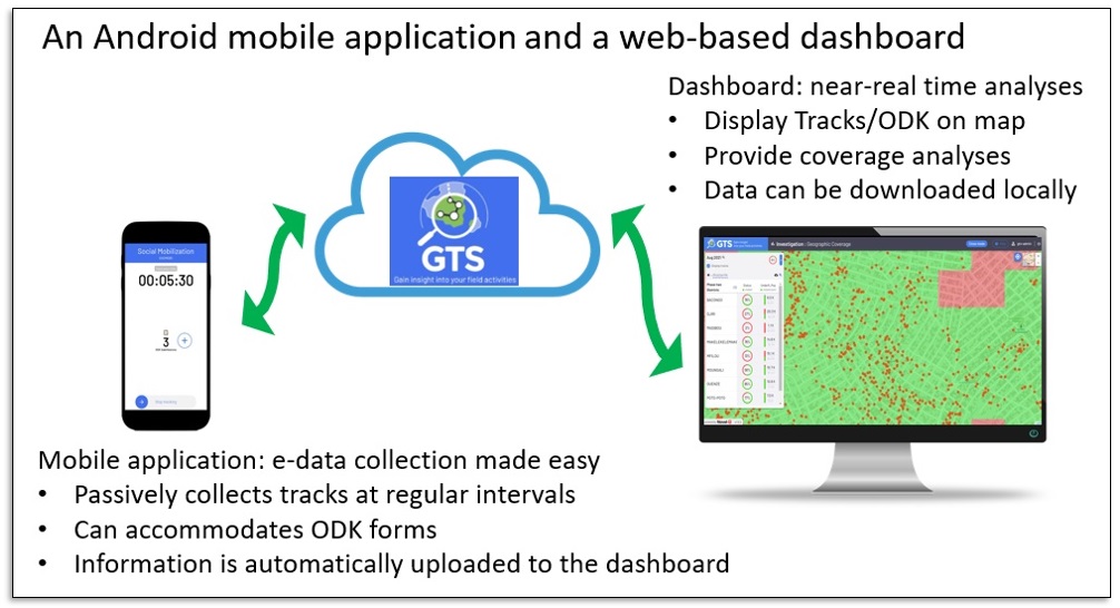
The GTS employs Android smartphones to collect data in the field and a cloud-based central server to manage activities, display data on maps and permit downloading of datasets for further analysis.
Android Mobile Application for tracking field staff activities.
Online Dashboard for Administration and Map Analysis.

Mobile Applications
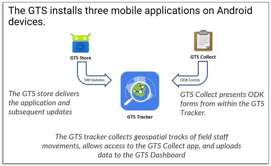
GTS Tracker The mobile tracking application is an intuitive easy-to-use tracking application that requires little or no field staff training nor manipulation. It constantly records geospatial coordinates based on dashboard configured interval and operating hour parameters to ensure accuracy and completeness of field activity tracking.
GTS Collect The GTS Collect is embedded in the GTS Tracker and can accommodate ODK Collect forms to capture and upload contextual data during field activities.
GTS Store The GTS Store is the app store used for the digital distribution and automatic updates of the GTS Mobile Application components.

Central Dashboard
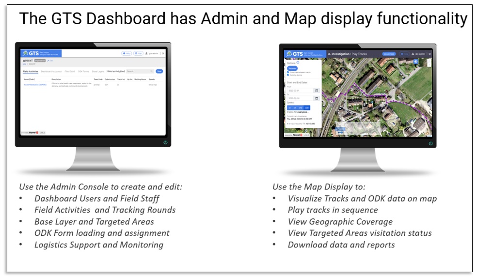
The GTS Dashboard includes an Administration Console to configure an Organization’s GTS instance and a Map Display Console to view Field Activity geo-spatially, view aggregated analysis, and download data for further processing.
Administration The GTS Server enables the creation and management of Organizations, Users, Field Activities and Field Staff accounts.
Display The GTS Server enables tracking data to be shared and disseminated while provisioning for the protection of sensitive information. It displays collected tracks graphically on maps and permits the download of selected tracks, in various formats, for offline analysis.
